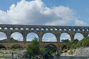

Here you are in front of the Pont du Gard, which you can reach from the city by car or by liO network coach. This bridge was never designed for cars: it is a Roman aqueduct, built in the first century, between 40 and 50 AD, under the emperor Claudius. It carried water collected near Uzès all the way to Nîmes, over more than 50 kilometres, with a total drop of only 12.6 metres. Look at its three tiers of arches: 6 at the bottom, 11 in the middle, and a row of small arches at the very top, where the channel ran. It rises to 48.77 metres above the Gardon. The limestone blocks, quarried at the nearby Estel quarry, are laid almost entirely dry, without mortar. Go up to the piers: you will see projecting stones and masons’ marks, such as the inscription FRS II, as well as graffiti left by visitors over the centuries. It is estimated to have carried around 40,000 cubic metres of water a day. Listed as a historic monument as early as 1840, it has been a UNESCO World Heritage Site since 1985.
History
The Pont du Gard was built in the first century, between 40 and 50 AD, during the reign of the emperor Claudius. It is part of an aqueduct more than 50 kilometres long that carried water from a spring near Uzès to Nîmes, with an average gradient of 24.8 centimetres per kilometre.
It was listed as a historic monument in 1840 and inscribed as a UNESCO World Heritage Site in 1985. Today it receives more than 800,000 visitors a year, 40 per cent of whom come from abroad.
Art and architecture
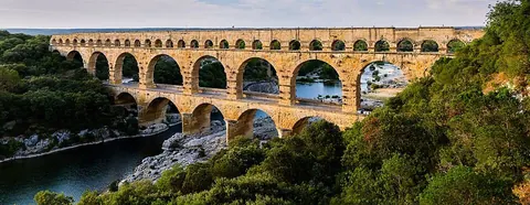
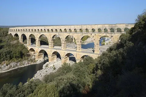
The structure stacks three tiers. The first has 6 arches, 142.35 metres long and 21.87 metres high. The second has 11, over 242.55 metres and 19.50 metres high. The third, 7.40 metres high, carried the channel; it now has 35 arches, 12 having disappeared. The whole reaches 48.77 metres above the river and is 275 metres long, compared with about 360 originally.
The channel is 1.80 metres high and 1.20 metres wide, with a gradient of 0.04 per cent. The limestone comes from the Estel quarry, and the blocks are assembled almost entirely dry, without mortar.
Anecdotes
The flow is estimated at around 40,000 cubic metres a day, nearly 460 litres per second.
The stones bear builders’ marks, such as FRS II, protective symbols and inscriptions left by visitors from different centuries.
What to look for
From the riverbank, compare the width of the three tiers: the highest is the longest, the lowest the most massive. Look for the small arches at the top, where the channel ran, then go up to the piers to spot marks and graffiti.
Practical
Without a car, the regional liO coach network serves the area from Nîmes: check the route, timetable and journey time on the liO website before you leave. Opening hours, prices and access conditions for the site: pontdugard.fr.
Bring good shoes and water in summer: the site is in the open air.
Nearby
The aqueduct arrived in Nîmes at the castellum aquae, the water distribution basin, which you can see in the city. Its source was near Uzès, the Eure spring: Uzès combines easily with the Pont du Gard in a single day.


On site, look for: On the piers of the lower tier, look for a mason’s mark or an old graffito.
Test yourself
What was the Pont du Gard used for?
- Carrying water (answer)
- Defending the river
- Letting chariots cross
How many arches does the lower tier have?
- 11
- 35
- 6 (answer)
Since when has it been a UNESCO World Heritage Site?
- 1840
- 1985 (answer)
- 2001
Sources
Information checked on 6 October 2026.